The Project
Project Overview
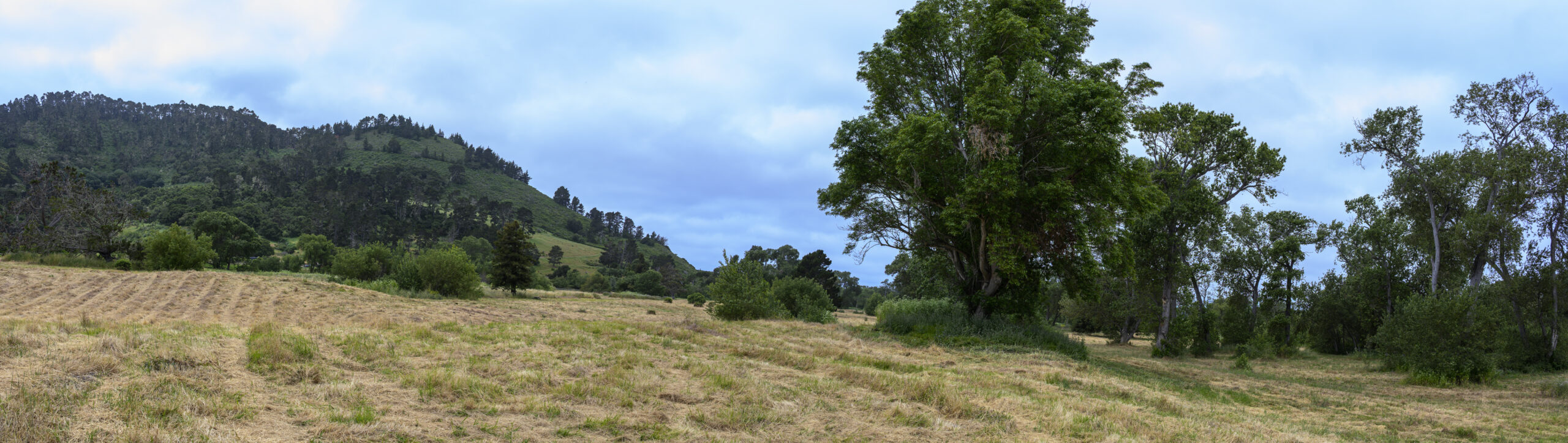
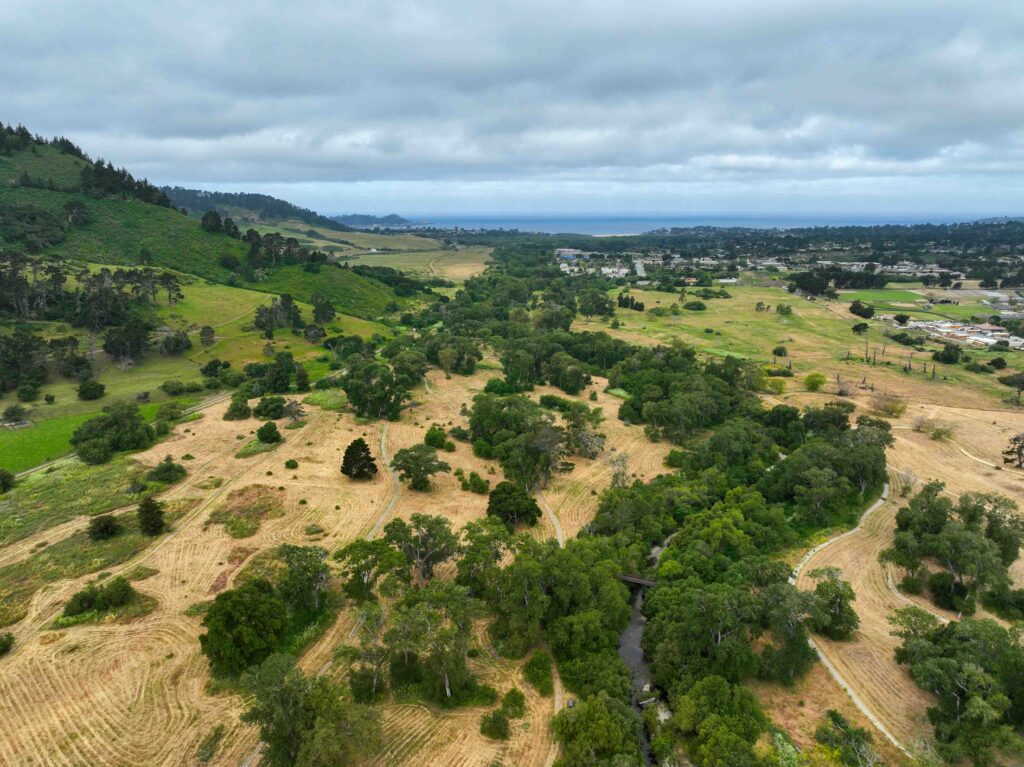
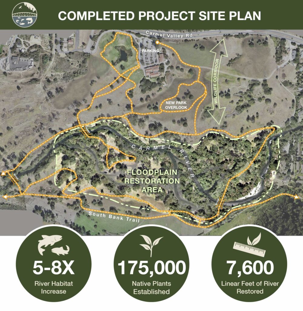
The Rancho Cañada Floodplain Restoration Project transforms 40 acres of a former golf course into thriving riparian habitat along a one-mile stretch of the Carmel River. This landscape-scale restoration reconnects the river to its historic floodplain, creating vital habitat for rare steelhead while providing natural flood protection and enhanced recreational access for the community. The project involves excavating 650,000 cubic yards of soil, removing constraining riprap, and establishing over 175,000 native plants to restore the natural processes that will make the Carmel River healthier and more resilient, allowing it to thrive as the defining feature of the Valley.
Building on decades of collaborative conservation efforts including the San Clemente Dam removal, this project represents the largest initiative in Monterey Peninsula Regional Park District‘s history. Made possible through partnerships with state and federal agencies, the restoration demonstrates how strategic collaboration can leverage $37 million in public investment to deliver benefits that extend far beyond the project boundaries – supporting recovery of steelhead, climate resilience, and a shared vision of environmental stewardship that honors both the land’s natural heritage and the community’s connection to it.
Project Goals
Steelhead Recovery
Reconnecting the Carmel River to its floodplain creates vital winter and spring rearing habitat for threatened South-Central California Coast Steelhead. The project provides slow-water refuge areas where young steelhead can grow larger before migrating to the ocean.
Wildlife Habitat Restoration
Creating diverse habitats supports year-round resident birds, seasonal migrants, and sensitive species like California red-legged frogs and Western pond turtles. The project expands habitat in a crucial wildlife corridor connecting the Santa Lucia Mountains to the Gablian Range and Santa Cruz Mountains.
Climate Resilience
Restored floodplains provide natural flood protection for neighboring communities by providing safe spaces for floodwater to spread. The project enhances groundwater recharge and helps the watershed adapt to extreme weather patterns.
Community Connection
The restoration creates new accessible trails and educational opportunities that connect people with the healing landscape. A new 260-foot pedestrian bridge will anchor an improved trail network providing enhanced access to Palo Corona Regional Park.
Where We Started
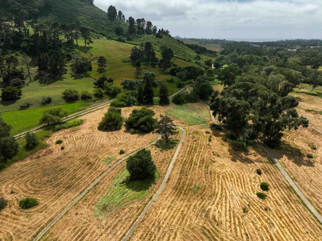
The Carmel River was once named one of America’s most endangered rivers. Historically, the river fanned out across the valley floor supporting vibrant ecosystems, but more than a century of agriculture and development cleared riparian forests and disconnected the river from its floodplain. The former Rancho Cañada Golf Course, while providing decades of recreation, represented this legacy of altered landscapes that constrained the river’s natural processes and left it deeply incised with the channel falling up to 20 feet below surrounding land.
MPRPD’s acquisition of this property in 2018 allowed for permanent protection of the land and dedication of its water rights back to the river, setting the stage for restoration. This project builds on decades of land conservation and restoration in the Carmel River watershed, including the San Clemente Dam removal and restoration efforts like Big Sur Land Trust’s CRFREE project downstream near the Carmel River Lagoon. Together, these complementary initiatives represent historic investments in restoring the legendary Carmel River steelhead runs that were once a hallmark of the watershed’s ecological richness, and are key to its recovery in the face of climate change.
The Work
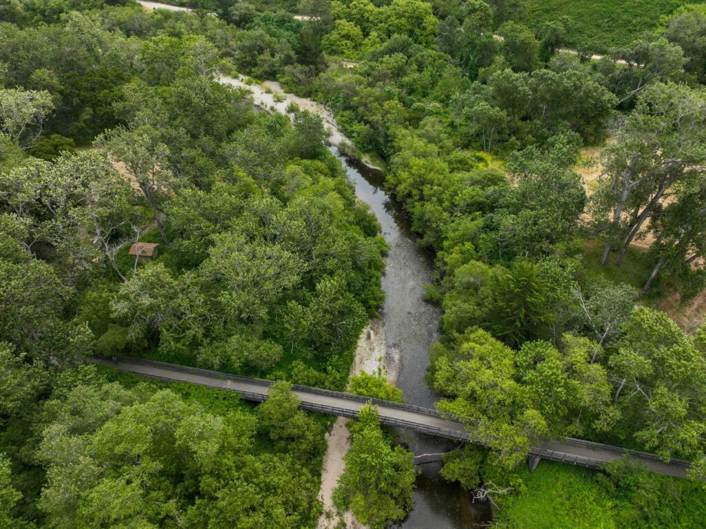
The restoration involves reshaping 40 acres through excavation of approximately 650,000 cubic yards of soil to lower disconnected floodplains and allow annual river inundation. The project removes 3,200 linear feet of riprap that has prevented natural river processes like channel migration and sediment transport. New backwater channels and alcoves will be created to provide critical slow-water refuge areas for juvenile steelhead during high-flow events, while wood features and gravel placement will enhance habitat complexity and connectivity.
Over 175,000 native riparian plants will be established, including culturally significant species identified through tribal consultation with the Rumsen Ohlone Tribe. The planting palette includes 30 diverse native species, all sourced locally to preserve regional genetic integrity and enhance ecological resilience. The project consolidates aging golf course infrastructure into a more resilient trail network anchored by a new 260-foot pedestrian bridge designed to accommodate natural river migration. Three existing bridges will be removed to provide additional space for the river’s natural processes while maintaining emergency access to 4,500 acres of Palo Corona Regional Park. Construction is phased over three seasons to minimize impacts on wildlife and park visitors, with most major earthwork occurring during dry summer months to protect water quality and aquatic species.
This project is made possible through funding from the State Coastal Conservancy, National Fish and Wildlife Foundation, Wildlife Conservation Board, and NOAA. With $37 million in state and federal grants, it represents a significant investment in the community’s nature-based economy and environmental future.